■ In
this post we will present Tell Gomel, the site chosen by our project for a future excavation.
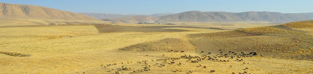
The
site of Tell Gomel
stands in the heart of the Navkur Plain, an alluvial plain that lies
south of the Erbil-Dohuk road, between Jebel Maqloub and the
Bardarash region and the Al-Khazir river to the east.
.jpg) The
focal point of
settlement throughout the Navkur Plain was the urban site of Tell
Gomel, located on the River Gomel near the modern town of Kalakchi,
which probably corresponds to the Assyrian Gammagara (referred to in
the Jerwan B Inscription of Sennacherib as an “URU”, a city). The
preliminary survey of the Tell Gomel site conducted by IAMA
documented the existence of a settlement sequence ranging from the
Chalcolithic to the Ottoman period (c. 5000 BC- early 20th century
AD).
The
site, which now covers a total area of about 16 ha, features an
elevated upper town (about 40 m above the surrounding plain) that
dominates an extensive lower town. Due to its large size and position
in the centre of the plain, Gomel must undoubtedly have played an
important role in this region – presumably as its political and
economic centre.
 The
area around Gomel is of great interest because of its central
position in the heart of the Navkur Plain, the
most intensively settled landscape in the LoNAP area. This territory,
with abundant water and fertile soils, constituted a trade-route hub
from the Late Chalcolithic onwards. In later periods the area was
strategic for commercial routes, but also for military transit and –
in the case of the Neo-Assyrian empire – for communications between
the Turkish Upper Tigris regions rich in resources and the principal
Assyrian cities.
The
area around Gomel is of great interest because of its central
position in the heart of the Navkur Plain, the
most intensively settled landscape in the LoNAP area. This territory,
with abundant water and fertile soils, constituted a trade-route hub
from the Late Chalcolithic onwards. In later periods the area was
strategic for commercial routes, but also for military transit and –
in the case of the Neo-Assyrian empire – for communications between
the Turkish Upper Tigris regions rich in resources and the principal
Assyrian cities.
Furthermore,
Sir Aurel Stein in his Limes Report (1938-1939, published in 1985)
proposed that
the battlefield of Gaugamela was in the plain surrounding Tell Gomel,
where in 331 BC Alexander the Great defeated Darius III, thus
definitively conquering the Persian Empire.
An
excavation here will throw light on its long settlement history and
yield well-stratified
typological series of pottery, lithics and other archaeological
artefacts, that will also be dated absolutely by means of a
programme of radiometric date determinations. This will give us
stratigraphic and typological reference sequences, enabling us to
better identify the surface finds gathered during survey work, refine
the dating of surveyed sites and thus produce more reliable
distribution maps of sites divided according to chronological period.
%2B-%2BCopia.jpg)
■ In questo post vi
presenteremo Tell Gomel, il sito scelto dal nostro progetto per
l'apertura di un futuro scavo archeologico.
Il sito di Tell Gomel si
trova nel cuore della Piana di Navkur, una piana alluvionale che si
estende a sud della strada Erbil-Dohuk, tra il Jebel Maqloub, la
regione di Bardarash e il fiume Al-Khazir a est.
 Il sito urbano di Tell
Gomel, situato sulla riva orientale del fiume Gomel vicino alla
moderna città di Kalakchi, occupa una posizione centrale nella Piana di Navkur e può probabilmente essere identificato nell'assira
Gammagara (definita “URU”, quindi città, nell' Iscrizione B di
Sennacherib a Jerwan).
Il sito urbano di Tell
Gomel, situato sulla riva orientale del fiume Gomel vicino alla
moderna città di Kalakchi, occupa una posizione centrale nella Piana di Navkur e può probabilmente essere identificato nell'assira
Gammagara (definita “URU”, quindi città, nell' Iscrizione B di
Sennacherib a Jerwan).
La ricognizione
preliminare del sito condotta dalla Missione
Archeologica Italiana in Assiria (MAIA) ha documentato l'esistenza di
una sequenza insediamentale dal Calcolitico fino al periodo Ottomano (circa 5000 a.C. - inizi del XX secolo d.C.).
Il sito, che oggi copre
un’area totale di circa 16 ha, è caratterizzato da una città alta
(circa 40 m sopra la piana circostante) che domina su un'estesa città
bassa. Date le sue grandi dimensioni e la posizione centrale, Gomel deve aver indubbiamente giocato un ruolo
determinante nella Piana di Navkur, l'area dove si concentra il
maggior numero dei siti archeologici individuati da PARTeN.
Questo territorio, ricco
di corsi d'acqua e dal suolo fertile, ha di fatto costituito un vero
e proprio snodo commerciale dal Tardo Calcolitico in poi. In epoche
più tarde l'area divenne strategica non più solo per le vie
commerciali che la percorrevano, ma anche per i transiti militari, e
– nel caso dell’impero Neo-Assiro – per le intense relazioni tra
le regioni dell’Alto Tigri turco, ricche di risorse, e le
principali città assire.
Sir Aurel Stein
nel suo Limes Report (1938-1939, pubblicato nel 1985) ha proposto che
la battaglia di Gaugamela, nella quale nel 331 a.C. Alessandro Magno sconfisse Dario III, conquistando definitivamente l’Impero
Persiano, si fosse svolta proprio nella piana circostante Tell Gomel.
L'apertura di uno scavo archeologico a T. Gomel potrà aiutarci a chiarire la sua lunga storia insediamentale e a ottenere una sequenza stratigrafica utilizzabile a fini comparativi. Questa ci fornirà nuovi riferimenti tipologici, permettendoci di valutare con maggiore precisione i ritrovamenti di superficie raccolti durante il lavoro di ricognizione, affinare la datazione dei siti esplorati e quindi produrre mappe di distribuzione più affidabili.
Thank you so much for sharing a lot of this good content! I am looking forward to seeing more!
ReplyDeleteLinder Surveying
زۆر جوانە
ReplyDeleteThanks for providing this helpful information.
ReplyDeleteRegards,
Faisal (Web Development Pakistan)